At Geoprecise Services Limited, our smart city data solution services are tailored to address urban challenges with innovative, data-driven approaches. By integrating IoT, GIS, and sensor technologies, we provide actionable insights that optimize urban infrastructure, such as traffic flow, waste management, energy usage, and environmental surveillance. Our solutions combine cross-agency data with community insights to preemptively tackle civic problems, fostering sustainable and efficient city management. From enhancing public safety to improving resource allocation, we empower cities to operate smarter, more sustainably, and with greater responsiveness to residents’ needs.
Urban Mobility Planning
As a company committed to advancing urban development and smart city initiatives, our urban mobility planning services aim to meet the evolving transportation needs of people and businesses. Using advanced spatial analysis, we design strategies to improve traffic flow, optimize transportation networks, and enhance public transit systems. Our solutions reduce congestion, increase efficiency, and promote greener, more sustainable mobility options. By rethinking urban mobility, we contribute to better quality of life, economic growth, and the overall functionality of cities.
Land Use and Zoning Analysis
Effective land use planning and zoning are at the heart of sustainable urban development, and Geoprecise Services Limited excels in providing these critical services. We offer comprehensive consultancy on managing population growth, land use planning, zoning regulations, and urban expansion management, all tailored to the specific needs of rapidly growing cities. Our zoning analyses not only help minimize conflicts among land users but also enhance property values, creating harmonious and well-structured urban environments. Whether for residential, commercial, or industrial development, our expertise supports cities in achieving balanced and strategic growth.
At Geoprecise Services Limited, we are dedicated to delivering innovative solutions that shape the future of urban living. Our holistic approach combines technology, data analysis, and sustainable practices to create smart, livable, and well-planned urban environments.
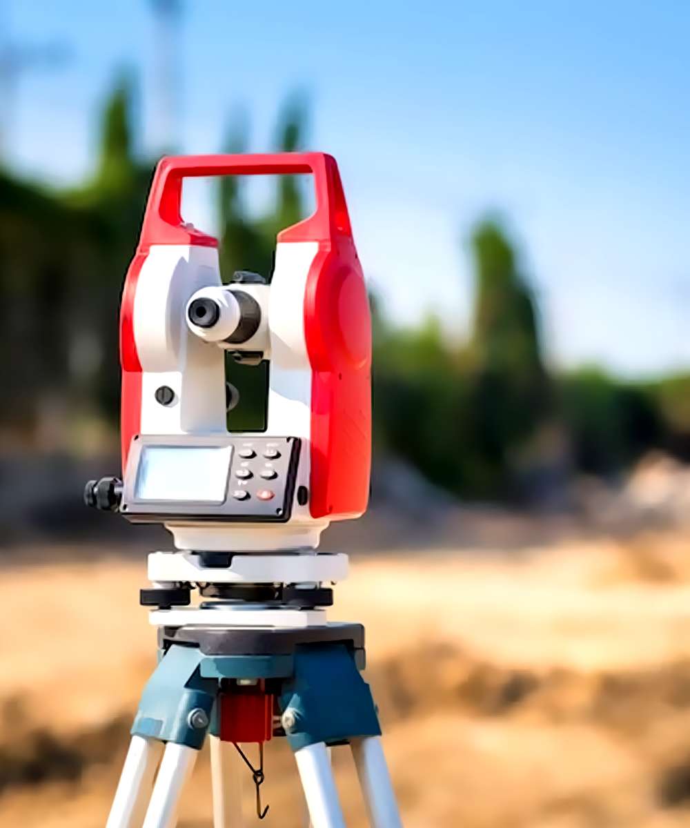
Engineering surveys are crucial for any building or engineering project, as we at Geoprecise Services Limited are keenly aware. To ensure that our clients receive accurate, reliable, and comprehensive data, we uphold the highest standards of professionalism and precision in every survey we conduct. Our dedicated team of expert surveyors is equipped with state-of-the-art tools and cutting-edge technology, enabling us to collect data with unparalleled accuracy and efficiency.
Beyond simply gathering data, we rigorously analyze the results to identify any potential issues, inconsistencies, or areas that may require further attention. Our goal is to provide our clients with clear insights, so they can make well-informed decisions for their projects. Once we complete the analysis, we take the time to thoroughly review the findings with our clients, ensuring that all concerns are addressed, and any questions are answered.
At Geoprecise Services, we approach each engineering survey with a deep understanding of the unique needs and objectives of our clients. We work closely with them to fully grasp their requirements and deliver a tailored solution that fits their specific project goals. Whether it’s for construction, infrastructure development, or land assessment, we ensure that the data we provide serves as a solid foundation for successful project outcomes, all while maintaining a high level of transparency and communication throughout the process.
In addition to our commitment to precision and thorough analysis, we understand that timing is critical in engineering projects. We pride ourselves on delivering our services promptly, without compromising on quality. We recognize that delays can affect the overall timeline of a project, which is why we are dedicated to providing accurate surveys within the specified timeframes. Our team works efficiently to meet deadlines and deliver results that allow projects to move forward smoothly.
Moreover, we place a strong emphasis on sustainability and environmental considerations. As the demand for environmentally conscious construction and development increases, we integrate these values into our surveying processes. Our surveys are designed to identify environmental factors that may impact the success or feasibility of a project, such as soil stability, water flow, and other relevant environmental conditions. By taking these elements into account, we help our clients make informed choices that are not only technically sound but also sustainable in the long run.
At Geoprecise Services, our commitment goes beyond just providing data. We aim to be a trusted partner throughout the entire lifecycle of a project, from initial planning and design through to construction and beyond. Our collaborative approach ensures that our clients always have the support they need to make the best possible decisions and achieve their project objectives with confidence.
At Geoprecise Services Limited, we specialize in the implementation of Spatial Data Infrastructure (SDI) frameworks designed to seamlessly manage and deliver geospatial data. Our SDI solutions consist of an integrated framework of geographic data, metadata, users, and tools that work interactively to maximize the utility of spatial data. Tailored to meet the specific needs of governments and large organizations, our SDI configurations enable the effective integration, management, and sharing of geospatial data across various systems. This approach ensures that organizations can streamline operations, improve decision-making processes, and enhance collaboration across departments.
Big Data GIS
In today’s data-driven world, managing and analyzing massive and complex spatial datasets is critical. At Geoprecise Services Limited, our Big Data GIS solutions are designed to handle the vast amounts of data generated by IoT sensors, satellites, drones, and other advanced technologies. We offer reliable and scalable systems to collect, store, analyze, and visualize these large datasets, providing actionable insights for applications such as smart city development, environmental monitoring, disaster management, and market analysis. Our expertise in Big Data GIS empowers organizations to extract meaningful trends and patterns, enabling data-informed decisions that drive success.
Cloud-Based Geospatial Solutions
Harnessing the power of cloud technology, our cloud-based geospatial solutions provide an efficient and cost-effective platform for storing, analyzing, and visualizing geospatial data. At Geoprecise Services Limited, we design scalable cloud infrastructures tailored to the specific needs of industries such as logistics, transportation, agriculture, and forestry. Our solutions ensure seamless access to geospatial data, improved operational efficiency, and reduced costs, enabling businesses to adapt to evolving demands. Whether it’s real-time data integration, large-scale geospatial analysis, or advanced visualization tools, our cloud-based platforms are built to support your goals with unmatched reliability and flexibility.
Our commitment to innovation and excellence ensures that every solution we provide at Geoprecise Services Limited is optimized to meet the unique challenges of our clients, paving the way for smarter, more effective decision-making in an increasingly complex world.
We provides people, communities, and governmental organizations with thorough property survey services. Our team of knowledgeable experts is committed to giving our clients accurate information that they can rely on when making decisions concerning their properties.
Our property survey services include land surveys, boundary surveys, topographical surveys, building surveys, and site engineering surveys, among other services. The most up-to-date surveying tools and technologies are used by our team to gather thorough information about the property, which is then examined to look for any potential problems or discrepancies.
Our land surveys are completed to determine precise property lines, which can assist in settling disputes between adjacent property owners. We also offer topographical surveys, which entail mapping the natural and built environments.
We conduct building surveys to find any potential problems with a building’s condition or construction. We examine the interior and exterior of the structure, as well as the foundation, walls, roof, and other structural components, and we offer a thorough report outlining any problems or concerns.
We collaborate with communities and governmental organizations in addition to private clients to conduct property surveys for public projects. In order to create a survey plan that satisfies their unique goals and expectations, we work closely with our clients.
At Geoprecise Services Limited, we’re dedicated to giving our clients accurate information they can trust so they can make wise decisions regarding their real estate investments. We take pride in our expertise, focus on the small things, and dedication to providing services of the highest caliber.
Geoprecise Services Limited is the best option if you need a trustworthy surveying company to conduct a property survey. You can be certain that the information you receive about your property is accurate and trustworthy thanks to our team of qualified experts and the most up-to-date surveying tools and technology. To learn more about our property survey services, get in touch with us right away.
Digital Elevation Model (DEM) and LiDAR Services
At Geoprecise Services Limited, we specialize in delivering high-quality Digital Elevation Models (DEMs) and LiDAR data services, providing a precise representation of the Earth’s topographic surface. Our advanced technology enables us to create high-resolution ground elevation models with exceptional vertical accuracy. These models are fundamental tools for various applications, including urban planning, flood risk assessment, environmental monitoring, and infrastructure development. Whether for large-scale regional analysis or detailed site-specific studies, our DEM and LiDAR services empower clients with the data they need for informed decision-making and project success.
Geospatial Data Analysis
Industries such as real estate, urban planning, and environmental management increasingly rely on satellite, drone, and GIS data analysis to derive actionable insights on patterns, trends, and predictions. At Geoprecise Services Limited, we provide top-tier geospatial data analysis services that involve the seamless collection, integration, and visualization of diverse geospatial datasets. Our expertise ensures that the data we deliver is accurate, insightful, and tailored to our clients’ specific needs. From identifying market opportunities in real estate to optimizing urban development plans, our geospatial analysis solutions are designed to drive success across industries.
3D Modeling and Visualization
Our 3D modeling and visualization services are crafted to deliver exceptional models of cities, terrains, or architectural projects. Whether for better planning, virtual tours, or simulations of future growth, our work sets the benchmark for excellence in 3D modeling. Recognized as one of the leaders in creating realistic and immersive 3D models, Geoprecise Services Limited is committed to overlaying the real world with innovation and precision. From urban landscapes to individual structures, our models provide valuable insights and enhance decision-making for developers, planners, and designers alike.
Interactive Web Mapping Applications
Our interactive web mapping application services revolutionize how clients process, view, and share geospatial data. By building custom GIS maps tailored to unique project requirements, we enable users to visualize complex datasets through intuitive and interactive platforms. These applications are invaluable for analyzing environmental changes, conducting demographic studies, or determining site suitability. At Geoprecise Services Limited, we transform geospatial data into actionable insights through visually engaging and user-friendly mapping solutions that support smarter decision-making.
Our dedication to leveraging cutting-edge technology, combined with a deep understanding of geospatial applications, positions Geoprecise Services Limited as a trusted partner for all your surveying and geospatial needs.