Service Tag: Solutions

Engineering Survey

Engineering surveys are crucial for any building or engineering project, as we at Geoprecise Services Limited are aware. In order to give our clients accurate and trustworthy data, we make sure that our surveying procedures are carried out with the utmost professionalism and accuracy. Our team of surveyors is outfitted with the most up-to-date tools and technology, which allows us to accurately and thoroughly collect data. In order to find any potential problems or contradictions, we also thoroughly analyze the survey results, which we then discuss with our clients. We approach engineering surveys by carefully analyzing the needs and demands of our clients. We carefully consider the demands of our clients and collaborate with them to provide a customized solution.
img-02

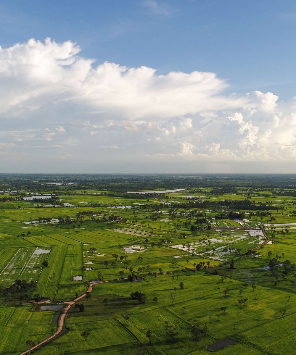
Aerial Data Collection

Aerial data collection services are provided to clients in a variety of industries by the reputed surveying company Geoprecise Services Limited. To gather top-notch aerial data for our clients, our team of skilled professionals uses the most recent tools and technologies.

Unmanned aerial vehicles (UAVs) or drones are used as part of our aerial data collecting services to collect data from the air, including photos, videos, and other sorts of data. To gather information on the terrain, structures, infrastructure, and other characteristics, we employ a variety of sensors, including high-resolution cameras, LiDAR, and multispectral sensors.

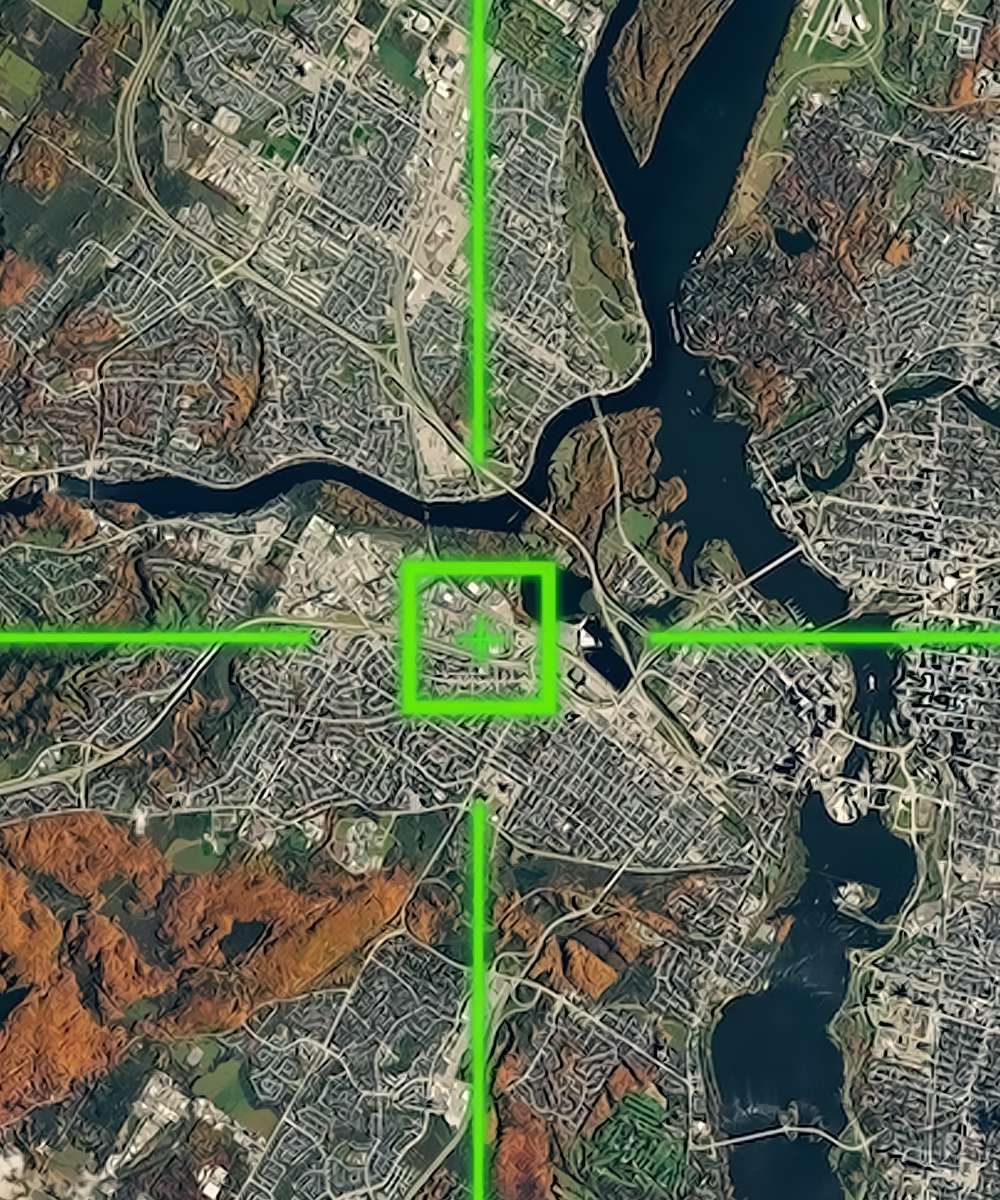
In addition to topographic mapping, 3D modeling, infrastructure inspections, and environmental monitoring, we provide a wide range of airborne data collection services. In order to plan construction projects, plan for land use, and manage natural resources, topographic mapping services are provided. These services entail the compilation of precise and detailed maps of the area.

The construction of precise digital models of the terrain, buildings, and other structures is a component of our 3D modeling services. These models can be utilized for planning, design, virtual tours, and visualization.

In addition, we provide drone-assisted infrastructure inspections, which look at structures including buildings, bridges, electricity lines, and other infrastructure. Our drones can record high-definition photos and videos, which enables us to see any potential problems or worries.

Finally, our environmental monitoring services include the use of drones to gather information about the environment, including the health of the plants and the purity of the air and water. The environmental effects of human activity can be monitored and lessened using the data provided.

At Geoprecise Services Limited, we’re dedicated to giving our clients access to high-quality aerial data so they can plan their projects wisely. Our team of skilled specialists has the competence and understanding to deliver precise and trustworthy data that satisfies the demands and standards of our clients.

In conclusion, Geoprecise Services Limited is the best option if you’re seeking for a reliable surveying company to handle aerial data collecting. To find out more about our aerial data gathering services and how we can support you in completing your project goals, get in touch with us right now.

img-02

GIS Mapping Services

The comprehensive Geographic Information System (GIS) and Digital Mapping Survey services provided by Geoprecise Service Limited are available to a diverse group of customers in a variety of business sectors. In order to deliver individualized solutions that are tailored to the precise needs of our customers’ individual projects, the highly trained specialists that make up our team are supported by cutting-edge hardware and software technologies.


Our services for GIS and digital mapping surveys include the following:


Data Collection: In order to acquire geospatial data that is accurate and precise, we make use of sophisticated surveying equipment such as GPS/GNSS, total stations, and unmanned aerial vehicles (UAVs). Our team guarantees that the data is captured effectively and precisely, hence reducing the number of errors that occur and improving the overall quality of the product.


Processing of the Data: In order to process the data that was obtained during the survey, we make use of modern software tools. The data that was obtained is analyzed and manipulated by our team using the most recent version of the GIS software, including Esri ArcGIS, AutoCAD Map 3D, and QGIS.


Digital Mapping: In order to generate maps of the surveyed areas that are superior in terms of quality, precision, and depth, we make use of several digital mapping techniques. In addition to the development of 2D and 3D maps, contours, and terrain models, the digital mapping services that we offer also include the construction of individualized maps that are catered to the particular requirements of each individual customer.


Data Visualization: In order to assist our customers in better comprehending and analyzing their geospatial data, we make available to them visualization tools that are both interactive and dynamic. The development of dynamic web maps, dashboards, and tools for spatial analysis are all part of the data visualization services we offer.


GIS Consulting: Our team of industry professionals offers GIS consulting services to clients in order to assist them in optimizing both the GIS infrastructure and the workflows associated with it. We offer individualized solutions for geographic information systems (GIS), such as database design, software development, and GIS training.


Our clients come from a wide range of businesses, including government organizations, engineering firms, construction companies, environmental consulting firms, and natural resource management agencies. These clients employ our GIS and Digital Mapping Survey services. Get in touch with us right away to find out more about the GIS and Digital Mapping Survey services that we offer, as well as the ways in which we can assist you with your next project.


GIS Services For:

img-02